How Neoscape built a full-corridor digital twin flythrough for the METRO Blue Line Extension — and why visualization has always been at the heart of how cities bring communities along for the ride.
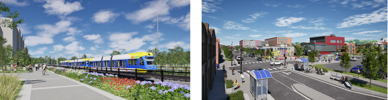
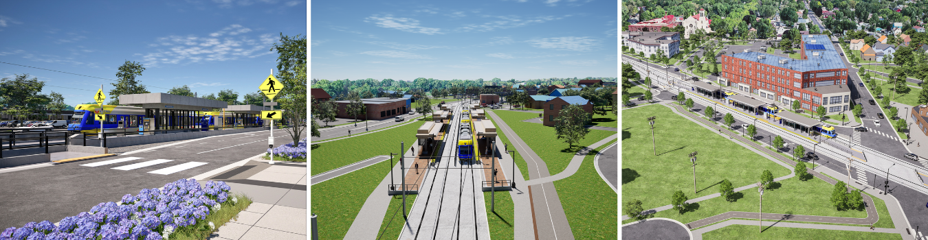
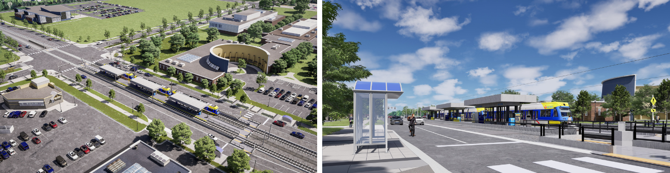
The challenge? Render 13.4 mi of light rail corridor, 13 new stations, and create a 10+ min full flythrough animation that includes it all.
Before a single rail is laid
Large-scale infrastructure projects face a challenge that engineering specs alone can’t solve: getting people to believe in something that doesn’t exist yet. When communities, stakeholders, and local governments are asked to support a project of this magnitude — 13 new stations, 13.4 miles of new light rail track — the gap between proposal and reality can be the difference between a project that moves forward and one that stalls.
This is a challenge Neoscape has been solving for a long time. Some of our earliest work involved creating renderings for Boston’s Big Dig, one of the most ambitious and controversial infrastructure projects in American history, specifically to help communicate the vision to the public and generate community buy-in.
Decades later, the mission is the same. But the technology is something else entirely.
Building a digital twin at corridor scale
For the METRO Blue Line Extension, Neoscape created a full-corridor digital twin environment: a real-time, geospatially accurate 3D model of the entire future route. From this environment, we rendered a 10+ minute flyover animation covering every station and every mile of track, giving the project team, public officials, and community stakeholders a visceral, immersive sense of what this infrastructure will look like and how it will connect people across the region.
The scope of this project introduced a significant technical challenge: animating at this scale, with this level of environmental fidelity, is enormously demanding on rendering performance. To address this, our team implemented World Partition and other optimization techniques — systems that intelligently load and unload geometry based on the camera’s position along the corridor. The result is a seamless, fluid animation that maintains a user-friendly framerate throughout, without sacrificing visual quality.
Why this matters beyond the render
A flythrough of this quality is truly a community engagement tool. Residents along the route can see exactly how the extension will interact with their neighborhoods. Decision-makers can walk through the project before a single dollar is spent on construction. The animation becomes a shared reference point that aligns everyone: planners, politicians, press, and the public.
That alignment is what moves projects forward. And it’s what great visualization has always been for: from our early renderings of the Big Dig to a 10-minute digital twin flyover of Minneapolis’s future light rail.
A platform for what comes next
Because this work lives in a real-time environment, not a pre-rendered scene, it can be updated and extended as the project evolves. Station designs change. Alignments shift. New stakeholder audiences need to be reached. The foundation Neoscape built is designed to adapt alongside the project it represents.
Back to Blog